Why book this drive
Why book this drive
The climb is the point
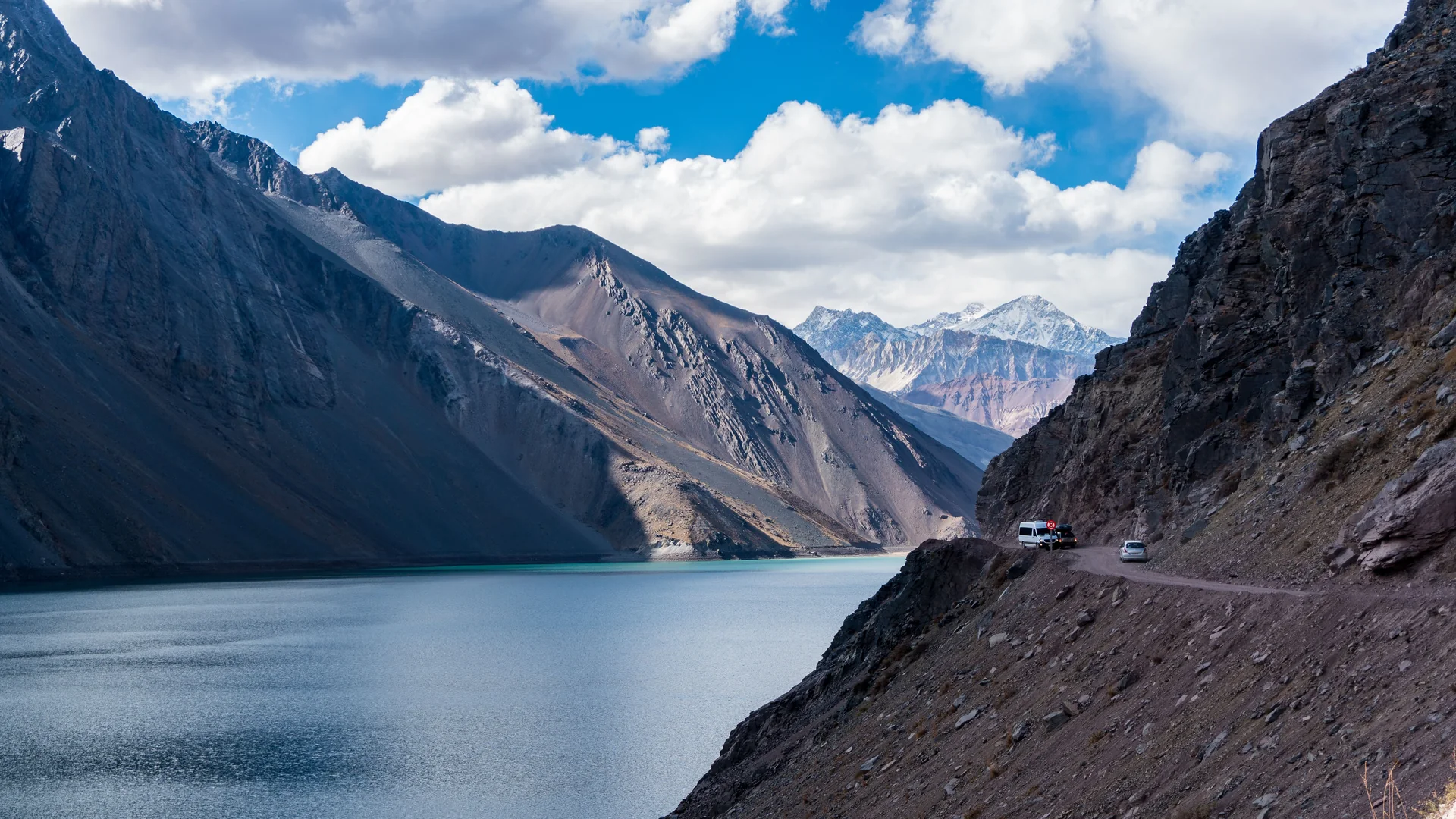
Santiago sits at about 520 metres. Embalse El Yeso sits at about 2,500. The tour makes that entire climb in one morning, on a paved road that turns to switchback gravel for the last stretch — a genuinely different day out from a city bus tour, and worth going into with that expectation set correctly.
One colour, and a real reason for it
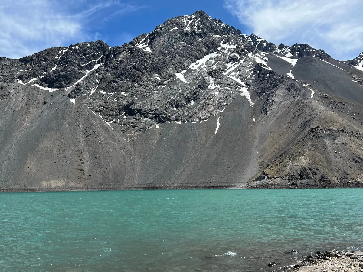
The reservoir's turquoise comes from glacial flour — fine rock dust ground by ice further up the Andes and carried down in meltwater, fine enough to stay suspended and scatter light back as that particular blue-green. It isn't a filter or a trick of the photo; stand at the shore and the colour is exactly what the pictures show.
A picnic with the view doing the work
The included picnic is set out in the open at a stop in the canyon rather than at a restaurant, which is the trade the day is built around: less time at a table, more time with the Andes around you while you eat.
Read the rating for what it is
Go in knowing what this is: a long day, mostly in a van. The reservoir itself is the reward; the hours spent getting there and back are the cost, so treat it as a mountain road trip with a spectacular destination rather than a short excursion.
The climb
The climb, stop by stop
Santiago sits at roughly 520 metres above sea level. The reservoir sits at roughly 2,500. Here is where those two thousand metres actually go, and how far into the day each stretch falls.
- Santiago · 520 m
Pickup, city still asleep
Vans collect from a mapped zone of central Santiago hotels before the morning traffic builds, heading southeast toward the mouth of the canyon.
- San Jose de Maipo · 1 060 m
The canyon's own town
The commune's capital, and the last town of any real size before the road narrows — plaza, church, and the last reliable phone signal for a while.
- Lo Valdes turn-off · 1 800 m
Where the asphalt runs out
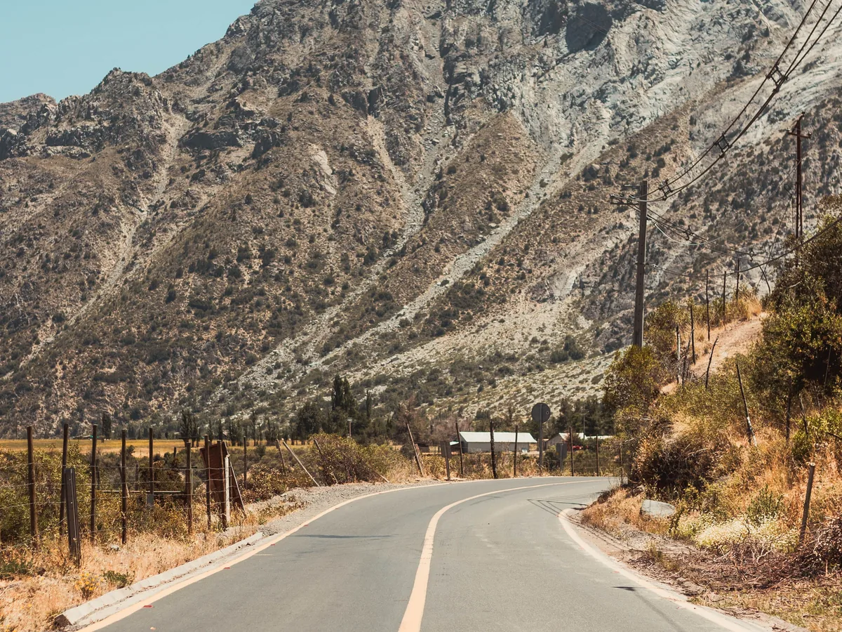
Around here the paved road gives way to a narrower gravel track for the final climb — switchbacks, no guardrail in places, and the reason this leg takes longer than the map distance suggests.
- Embalse El Yeso · 2 500 m
The reservoir
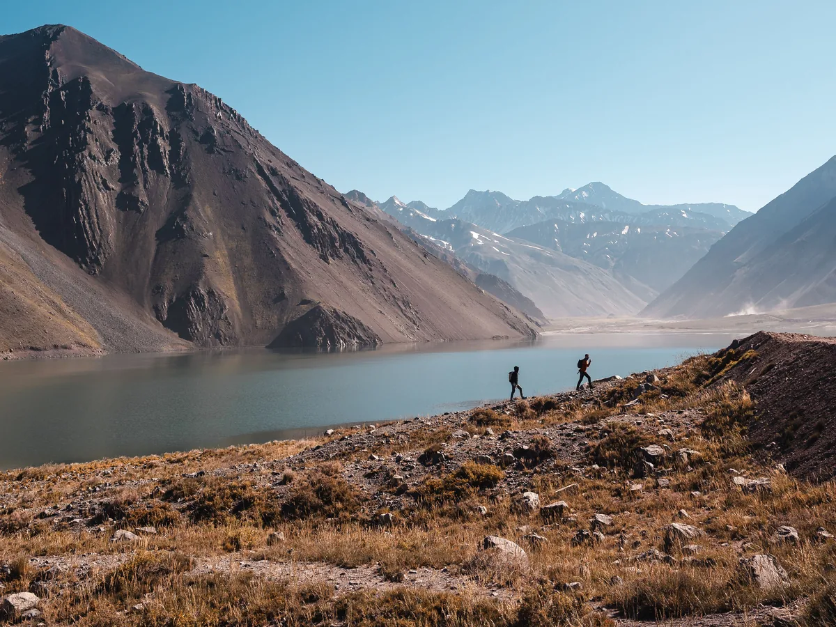
About two hours at the top: the shoreline, the view up the valley toward the peaks that feed it, and a guided walk while the wind decides how long the jacket stays on.
- Back in Santiago · 520 m
Down before dark
The same road in reverse, with the switchbacks easier to read in afternoon light than they were before sunrise — arriving back with the whole two thousand metres behind you.
Three things worth knowing before you go: air temperature drops by roughly 6-7°C for every 1,000 metres you climb, on top of whatever the wind is doing at the reservoir; altitude effects such as headache, breathlessness or tiredness are common and usually mild above about 2,500 metres, more likely if you flew into Santiago in the last day or two; and the fix for most of it is the same — water, a warm layer, and not rushing the last stretch of gravel.
The day, hour by hour
The day, hour by hour
A long day with a short list of things that actually happen on it — here is the order.
- ~7:30am
Pickup
Guides collect guests from a mapped zone of central Santiago hotels; the exact pickup time is confirmed with the booking.
- ~8:30am
Through San Jose de Maipo
The van passes through the canyon's main town, the last stretch of properly paved, two-lane road before the climb steepens.
- ~9:45–10:45am
The gravel switchbacks
The slowest, most dramatic leg: a narrow unpaved road climbing the final several hundred metres in tight turns above the valley floor.
- ~10:45am–12:45pm
Embalse El Yeso
Time at the reservoir itself — the shoreline, photos and a guided walk, with roughly two hours on the ground before the return leg starts.
- Early afternoon
Back down the canyon
The descent retraces the route, with a stop on the way down for the included picnic and some free time.
- ~5:30–6:30pm
Drop-off in Santiago
Back at the same hotel zone, roughly eight hours after pickup, in time for a late dinner rather than an early one.
The picnic, the wind, and what to bring
The picnic, the wind, and what to bring
What actually happens at the top, and a couple of things worth knowing before you assume they're part of the day.
What's on the picnic
The tour we link to includes a picnic at a stop in the canyon, but breakfast and lunch are not included, so eat before pickup and bring extra food for a long day. The picnic's contents aren't published; ask when you book if a particular diet matters to you.
The wind is part of the day
The reservoir sits in an exposed, treeless bowl above 2,000 metres, and the wind there is routinely stronger than anything felt in Santiago that morning — bring a windproof layer even on a forecast that looks calm from the city.
Hot springs are a different trip
Termas de Colina and Banos Morales are real hot springs elsewhere in the same canyon, and some operators sell a combined itinerary that includes one of them. This listing does not — it is the reservoir and the picnic, not a soak, so check the specific inclusions if hot water is what you're after.
Supply here is fragmented, not exclusive
Dozens of Santiago agencies run close variations of this same route, under different listing titles and with different extra stops. That's good for choice and bad for consistency — read the specific inclusions on whichever listing you book rather than assuming they match a friend's trip from last year.
The canyon and the reservoir
The canyon and the reservoir
The climb from the valley floor to the turquoise water at the top, and the road that gets you there.
Ways to do this route
Ways to do this route
| Option | What it includes | Good to know |
|---|---|---|
| Full-day van tour with picnic | Guide, van transport and a picnic stop; breakfast, lunch and the entrance fee not included | What this page books — roughly 8 hours door to door from your Santiago pickup |
| Tour with hot springs added | The same canyon route plus a stop at Termas de Colina or Banos Morales | A separate, longer product — check the specific listing if soaking is the point |
| Small-group or private version | Same route and stops, just a smaller van or a private car instead of the full-size group vehicle | Costs more; worth it if a standard shared van is what puts you off |
| Driving yourself | None of the guide, transport or picnic | The final stretch to the dam is narrow gravel with no guardrail in places — manageable in summer with a capable car, harder outside it |
Ways to book the day
Find a date for the climb
Each option below runs through GetYourGuide, with live seat availability for the El Yeso climb and your price confirmed in your own currency.
Planning the day
Planning the day
Dress in layers you can shed
Santiago mornings are mild; the reservoir is not. Pack a windproof outer layer even in summer, and expect to add and remove it more than once between pickup and the picnic.
Eat lightly before the switchbacks
The gravel climb above Lo Valdes is the part of the day winding-road motion sickness tends to show up on. Go easy on a heavy breakfast beforehand if that affects you, and sit toward the front of the van if you have a choice.
Confirm the date is inside the season
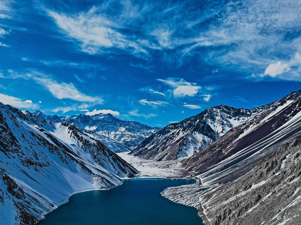
The upper road typically closes for winter — check that your date falls in the open season before you book, especially if you're travelling between roughly May and September.
Bring cash and your own water bottle
Entrance fees and any extras along the way are more reliably paid in Chilean pesos than by card, and a refillable bottle beats relying on what's provided for a day this long at altitude.
Planning a Cajon del Maipo day trip
Planning a Cajon del Maipo day trip
The Cajon del Maipo day, hour by hour
Pickup before eight, two thousand vertical metres by lunch, and back down before dark — here is the shape of the day, stage by stage.
Read more →The reservoir, explainedEmbalse El Yeso: what it is, why it's that colour, and the wind
A dam built in 1964, a colour that comes from ground-up rock, and a wind that the postcard photos never show.
Read more →Practical health notesAltitude, cold and the sun at 2,500 metres
What two thousand vertical metres in a morning actually does to a body that started the day at sea level — and the plain, unglamorous fixes.
Read more →What's actually on the dayThe picnic, and what to bring
What's typically included at the reservoir, what isn't, and the short packing list that makes the difference between a good day and a cold one.
Read more →Choosing your dateWinter vs summer in the canyon
The upper road to Embalse El Yeso doesn't run all year — here is what changes between the open season and the months it's closed.
Read more →Around SantiagoSantiago beyond the mountains
One day covers the Cajon del Maipo climb — the rest of the Santiago itinerary fits around it, from the city centre to the coast to the vineyards on the far side of town.
Read more →FAQ
Cajon del Maipo & El Yeso questions
What is the Cajon del Maipo and Embalse El Yeso tour?
It's a full-day van trip from Santiago that climbs through the Cajon del Maipo canyon and the town of San Jose de Maipo to Embalse El Yeso, a turquoise reservoir at roughly 2,500 metres in the Andes. Your ticket covers a bilingual guide, the van ride and a picnic; breakfast, lunch and the entrance fee are paid separately.
How high do you actually go, and is altitude sickness a risk?
Santiago sits at about 520 metres; the reservoir sits at about 2,500. Climbing that much in a single morning can bring on mild altitude effects — headache, breathlessness, tiredness — in some people, more likely if you flew into Santiago in the last day or two. It's rarely serious at this altitude; drink water, dress warmly and take it easy if you feel it.
Does this tour include hot springs?
No. Termas de Colina and Banos Morales are real hot springs elsewhere in the canyon, and some operators sell a combined itinerary with one of them, but this listing is the reservoir and picnic only. Check the specific inclusions if a soak is what you want.
What's in the picnic?
A picnic is included at a stop in the canyon, but breakfast and lunch are not, so eat before pickup and pack extra food. The picnic's contents aren't published; ask when you book if you have a specific diet.
Is Embalse El Yeso open all year?
No — the upper road typically closes for the Chilean winter, roughly April to the start of spring, due to snow and rockslide risk. Outside that window some operators substitute a lower-canyon itinerary. Confirm your date falls in the open season before booking.
How rough is the road, and should I worry about motion sickness?
The last stretch before the reservoir is narrow, unpaved and switchbacked, without guardrails in places. It's a real mountain road, not a highway, and it's the part of the day winding-road motion sickness tends to show up on — sit toward the front if that affects you.
Can I cancel if my plans change?
Yes. Cancel at least 24 hours before departure and you're refunded in full — some of these listings won't even take payment until closer to the date. Exact terms differ slightly by operator, so check the option you've picked at GetYourGuide checkout.